Research project Optimization of carbon indicators in the framework of LULUCF

General introduction
LULUCF (Land Use, Land Use Change, and Forestry) reporting in Flanders could be significantly optimized by making a broader and more accurate assessment of carbon stocks. This is evident from the research conducted by the CARBON FACTORS research project. Currently, only living biomass in forests is taken into account, while arable land, grassland, wetlands, and built lands also contain relevant carbon stocks. Tools such as CARAT and GRASSAT make it possible to better model carbon sequestration in woody elements and grasslands, but data for wetlands and natural grasslands remain limited. Organic soils, particularly under forests and in wetlands, contain significantly more carbon than mineral soils, but are not sufficiently taken into account. There is little information available on sealed land use, although international studies show that carbon storage also occurs in sealed ground. Countries such as the Netherlands and Germany use pragmatic assumptions about carbon losses from sealing, an approach that also seems feasible for Flanders. The project report concludes that a combination of better data, adapted models, and step-by-step implementation is needed to achieve more robust and complete LULUCF reporting.
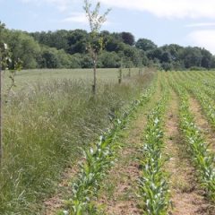
Research approach
For each type of land use (i.e., arable land, grassland, built land, and wetlands), the researchers searched for (i) existing datasets and allometric models to estimate the carbon stocks present in living biomass, and (ii) various existing map layers and other geographically explicit data to estimate the area of living biomass. In addition, solutions were sought for the obstacles to including peat soils in the reporting, such as the limited availability of high-quality measurements, the exact location and surface area of peat soils in Flanders, and the varying definitions of peat soils used in mapping and sampling. Finally, the available (Flemish) data were inventoried to estimate carbon storage under sealed lands.
Relevance/Valorization
One of the ambitions of the European LULUCF Regulation is to evolve towards an increasingly detailed level of estimation of LULUCF greenhouse gas emissions. Together with activity data (land use), carbon indicators form the basis for the LULUCF emissions inventory. For the latter, a combination of data from monitoring campaigns (Forest Inventory, Soil Carbon Monitoring Network) (~Tier 2/3), literature (~Tier 2) and IPCC guidelines (Tier 1) is used. This assignment investigated carbon indicators that are currently missing from LULUCF reporting in order to evolve to at least Tier 2. The focus was on living biomass, peat soils, and carbon storage in sealed land use. The results were recorded in a report.