Dossier Ruimte op zee
Our little sea occupies less than one percent of the total area of the North Sea, but it is intensively used. There are wind farms, dredging activities, sand mining and, of course, fishing, to name a few. Marine spatial planners try to coordinate these activities, taking into account the natural ecosystem.
What does ILVO do?
-
 ILVO monitors the marine environment in Belgian waters, including zones where human activities take place.

Why is planning needed in the Belgian part of the North Sea?
The Belgian part of the North Sea covers 3454 km², or only 0.5% of the total area of the North Sea. Many activities and functions converge in this small area:
- Fisheries
- Mariculture (growing food at sea)
- Renewable energy production (wind farms)
- Dredging
- Extraction of sand
- Shipping traffic
- Protected nature
- Recreation and tourism
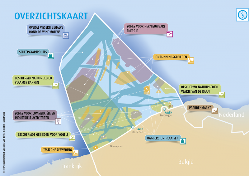
For optimal protection of the marine environment, it is imperative that all these activities be regularized, including by the Federal Government responsible for the marine area from the baseline.
The Marine Spatial Plan
With the North Sea Master Plan in 2005, the precursor to a marine spatial plan, Belgium was a pioneer in the world. This was followed in 2014 by the first Marine Spatial Plan (MRP), put into effect by the federal government for a six-year period. A new MRP has since been drawn up for the 2020-2026 period. That plan pays more attention to the ecological and socioeconomic value of activities at sea and puts 'integrated use of space' at the center. ILVO plays a key role in the study work to make such multiple or shared use of space possible.
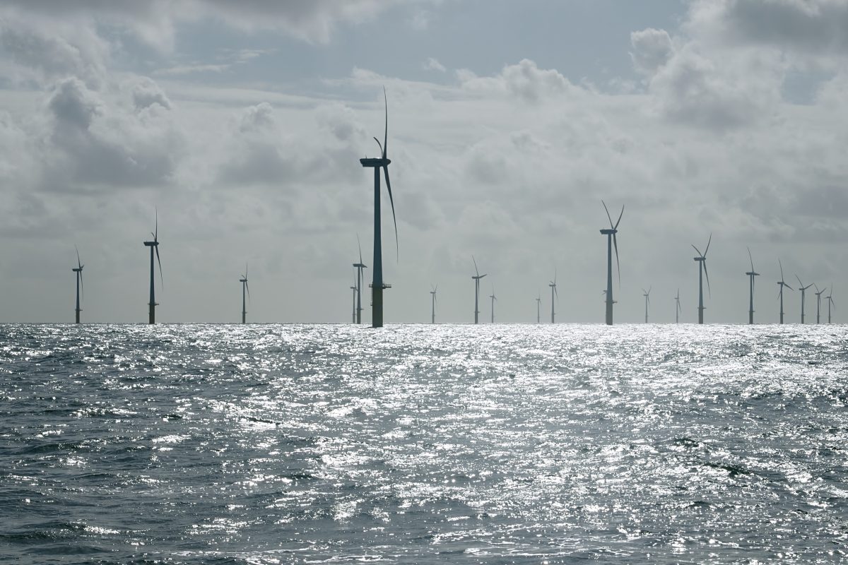
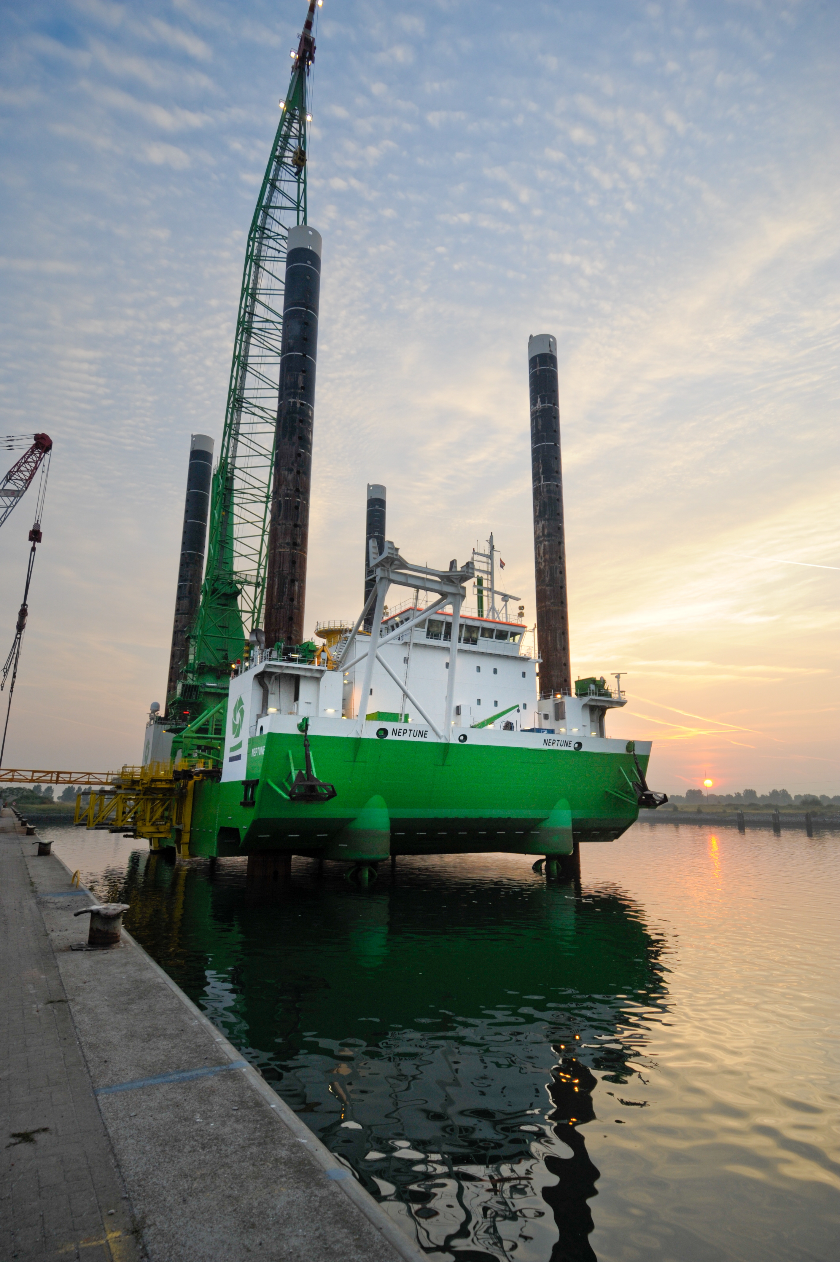
Renewable energy production requires (a lot of) space
Within the framework of European directives on renewable energy production, a zone for wind energy was demarcated off the coast of Zeebrugge. In 2008, C-Power started the construction of the first wind farm on the Thornton Bank. Meanwhile, 9 wind farms are already operational in this area. There is the Belgian Offshore platform for more information.
In the current 2020-2026 Marine Spatial Plan, a second area was created for offshore wind energy in the western part of Belgian waters. This new area was named the "Princess Elisabeth Windmill Zone" and should double its energy capacity by 2026.
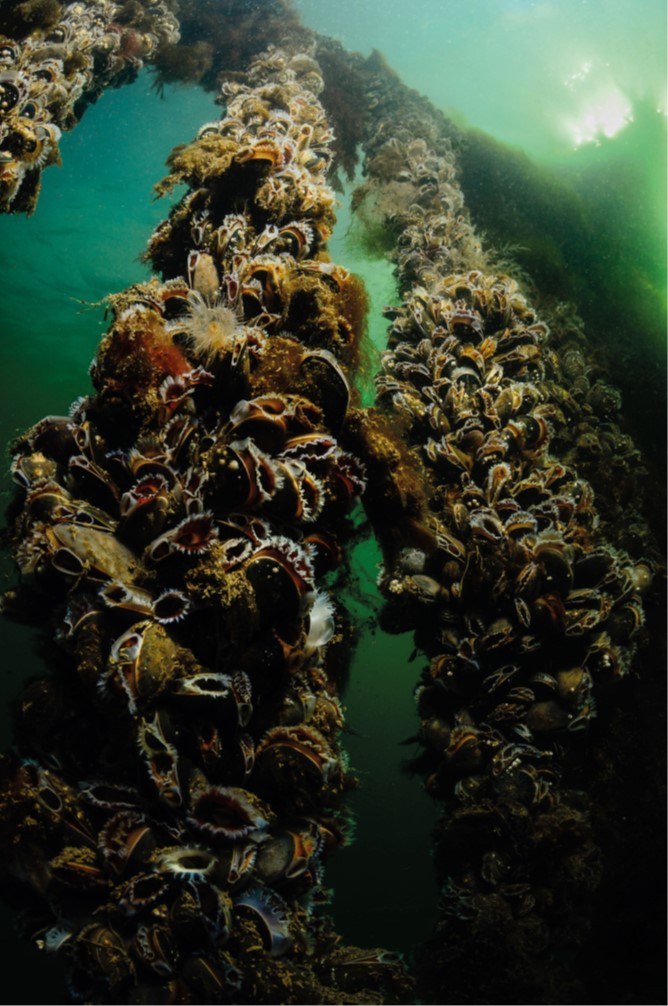
ILVO studies the effects of offshore wind farms on the bottom life of soft substrates (project OFFSHOREWIND). To this end, we conduct annual monitoring in the windmill areas and in reference areas.
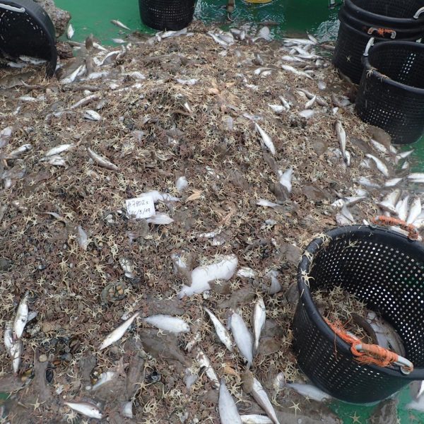
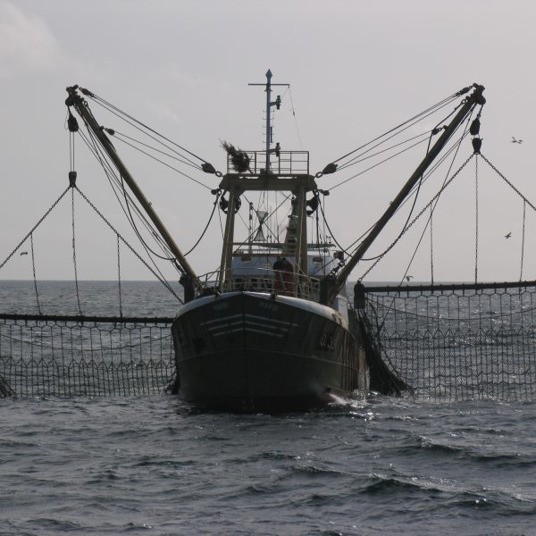
Fisheries (measures) mapped
The ever-increasing activity makes it more difficult for fishermen to keep their jobs. For example, there is a ban on active (beam trawling) fishing within windmill areas and additional fishing restrictions may be imposed in Natura 2000 areas. In the VISNAT project, ILVO provides advice to the European Commission on feasible fishery measures in protected nature areas, measures that harm the fishing industry as little as possible.
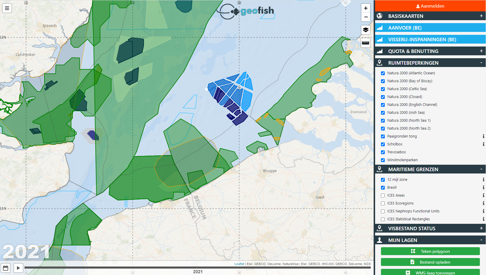
ILVO researchers have developed the GeoFish tool to bundle all these restrictions and make them clear to fishermen, ship owners and policy makers. It consists of interactive maps of the Northeast Atlantic - the areas in which Belgian fishermen are active. It includes information on current land use, fishing restrictions, fishing effort and fishing quotas.
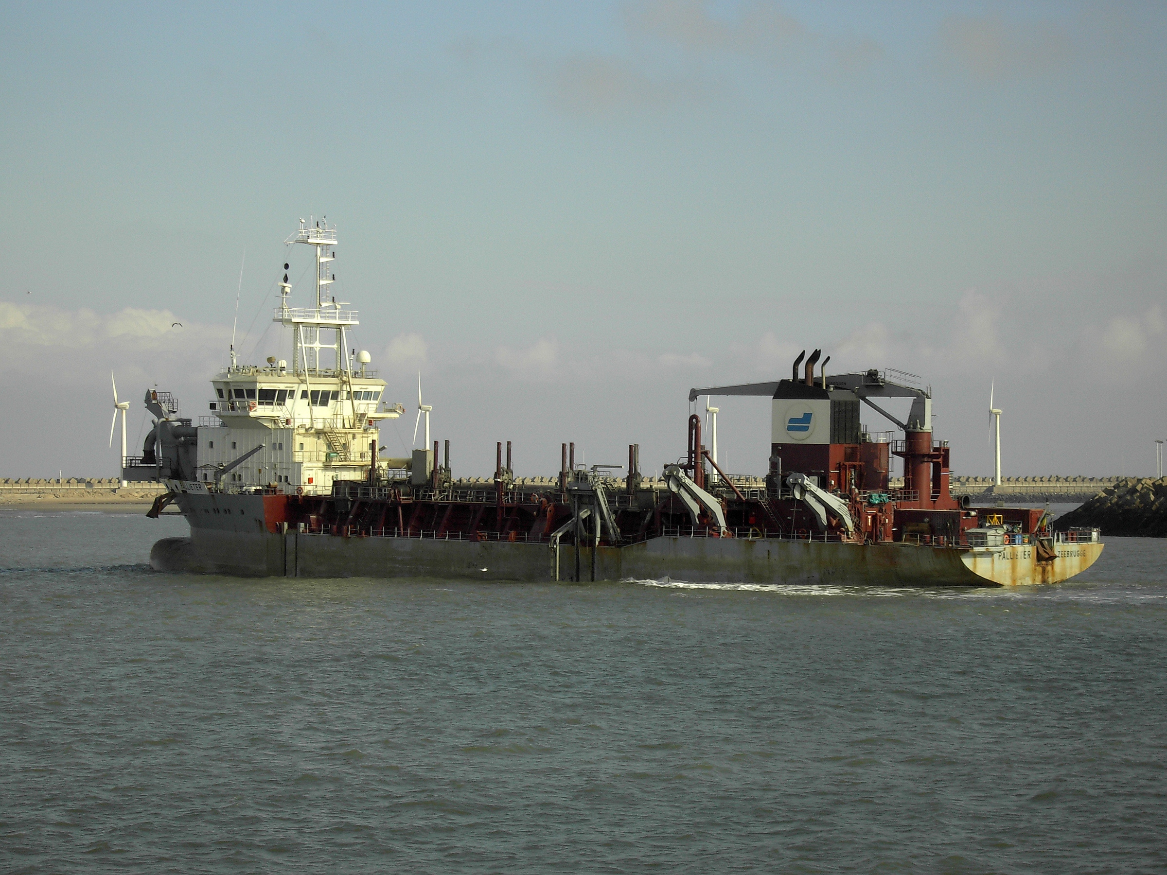
Dredging activities and sand mining
In the Belgian part of the North Sea, zones have also been defined for dredging activities and sand extraction. Dredging is necessary to clear harbors and navigation channels of silt. The dredged sediments are deposited at dredging sites off the Belgian coast. Furthermore, the North Sea is an important source of sand. That sand is used as a building material but also for beach embankments as coastal protection during storms. ILVO will collect samples at sea every six months to study the impact of these activities on the biological and chemical composition of the soil.
Integrated use of space: food + energy
Because spatial planning has many implications for the economic activities that take place there, the Marine Spatial Plan puts integrated use of space at its core. That means looking for ways to combine activities in certain zones.
A good example is mariculture and passive fishing in zones in front of wind farms. Unlike active (beam trawling) fishing, that form of food supply is allowed there. ILVO is investigating in SYMAPA whether it is possible. On the one hand by developing different cultivation techniques for mussels, flat oysters and seaweed. On the other by testing efficient passive fishing techniques, such as the use of fish cages in combination with light and sound.
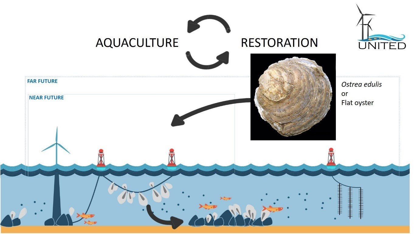
The European project UNITED also focuses on integrated use of space in the North Sea, Baltic Sea and Mediterranean. For Belgium, the project there is also investigating how offshore windmill areas can play a role in farming flat oysters and seaweed. By reintroducing the flat oyster (Ostrea edulis), this project also contributes to nature restoration.
Integrated use of space: food + coastal protection
Mariculture also plays a role in nature-inspired coastal protection. Mussel beds, for example, create natural reefs that provide protection from storms. The ILVO project COASTBUSTERS 2.0 is studying to what extent mussels, shell tube worms, seaweed and seagrass can play a role as "habitat engineers" in the formation of biogenic reefs and natural coastal defenses.